Generate 3D maps
Georeferenced models ready to embed, 3D print, or use in BIM, CAD workflows.
What can you generate?
Georeferenced 3D map models in a self-contained format with commercial-friendly license ( .glTF,
 .ifc,
.ifc, .obj,
.obj, .stl,
.stl, .3mf).
All formats are usable offline and independently of our platform. No dependency on third party services or API keys—your models will work forever, even if we disappear.
- Self-contained models
Export your models in the format that fits your workflow:
- .glTF – Ideal for web use, interactive experiences, and online embedding (the "JPEG of 3D").
- .obj (with texture) – Widely supported format for 3D models, compatible with most 3D software.
- .stl – Standard format for 3D printing, compatible with most software and printers.
- .3mf – Modern 3D printing format with multicolor and layer support.
- .ifc – Georeferenced models in UTM or EPSG:3857 for BIM and CAD workflows, enabling integration with architectural and engineering tools.
- Commercial use included
Unlike most of our competitors, our models are made from open data sources with commercial-friendly license. This means you can use them without restriction — you are even allowed to resell them if you want to.
Depending on the imagery source, you might need to attribute the imagery source somewhere when you reuse the 3d model.
- Optimized & lightweight
Our models are generated using a Triangulated irregular network mesh that makes them more lightweight and efficient to display.
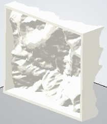
For 3D printing, models can be hollowed out to save material (70% cheaper to print).